

WIDE RANGE OF SERVICES TAILORED TO YOUR NEEDS
WIDE RANGE OF SERVICES TAILORED TO YOUR NEEDS
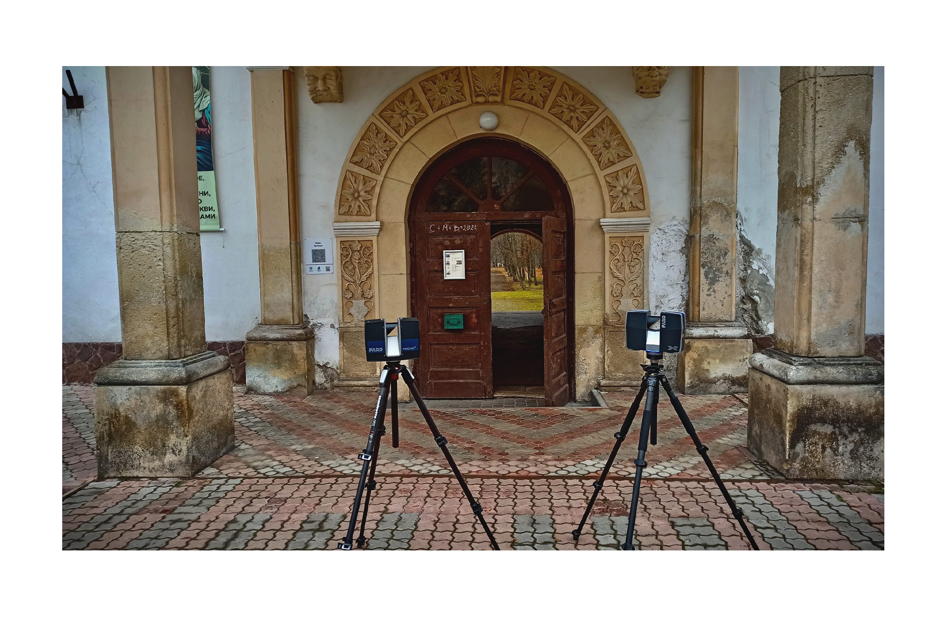
What is 3D scanning ?
Laser scanning is a technique that we use for extremely precise measurements and detailed registration of objects. The 3D scanner records hundreds of thousands of measurement points per second. Each point is a very precise measurement in the xyz axes. All these points together form a point cloud. The resulting cloud of points shows the actual reflection of the scanned object with an accuracy of 1mm.
Czym jest sknanowanie 3D ?
Skanowanie laserowe to technika, którą wykorzystujemy do niezwykle precyzyjnych pomiarów i szczegółowego rejestrowania obiektów. Skaner 3D rejestruje setki tysięcy punktów pomiarowych na sekundę. Każdy punkt to bardzo dokładny pomiar w osiach xyz. Wszystkie te punkty razem tworzą chmurę punktów. Powstała chmura punktów przedstawia rzeczywiste odzwierciedlenie skanowanego obiektu z dokładnością 1mm.
SCANNING 3D
You don’t know what 3D scanning is or what it can be used for ?
Find out more
- Capture the real properties of the measured object in high resolution
- Post-completion control of completed facilities
- Renovation / Reconstruction – minimization of the risk borne by the investor
- Reduction of the number of required site inspections
3D QUALITY CONTROL
Laser scanning works much better than traditional methods when verifying performed works
We offer:
- Deformation analysis
- Measurements of the flatness of floors
- Ceiling flatness measurements
- Virtual trial assemblies
- Measurements of reservoir deformation
- Tank volume measurements
- Measurements of steel structures
SKANOWANIE 3D
Nie wiesz czym jest skanowanie 3D lub do czego może posłużyć ? Dowiedz się więcej
- Uchwycenie rzeczywistych właściwości mierzonego obiektu w wysokiej rozdzielczości
- Kontrola powykonawcza wykonanych obiektów
- Renowacje/Przebudowy – minimalizacja ryzyka ponoszonego przez inwestora
Redukcja ilości wymaganych inspekcji na budowie
INWENTARYZACJE 3D
Skanning laserowy dużo lepiej sprawdza się od tradycyjnych metod przy weryfikacji wykonanych prac
Oferujemy:
- Analizy odkształceń
- Pomiary płaskości posadzek
- Pomiary płaskości sufitów
- Wirtualne montaże próbne
- Pomiary odkształceń zbiorników
- Pomiary objętości zbiorników
- Pomiary konstrukcji stalowych
KONTROLA JAKOŚCI 3D
Skanning laserowy dużo lepiej sprawdza się od tradycyjnych metod przy weryfikacji wykonanych prac
Oferujemy:
- Analizy odkształceń
- Pomiary płaskości posadzek
- Pomiary płaskości sufitów
- Wirtualne montaże próbne
- Pomiary odkształceń zbiorników
- Pomiary objętości zbiorników
- Pomiary konstrukcji stalowych
MEASUREMENTS FROM THE DRONE
Drones are characterized by high measurement accuracy and allow access to difficult places.
How do we use them?
- Land measurements for construction planning
- Preparation of terrain models
- Volumetric measurements, e.g. heaps of loose materials, scrap, etc.
- Control of the progress of works on the construction site
- Terrain Map Updates
- Making orthophotos
- Landslide measurements
SPACE MONITORING
The SENCEIVE system is an intelligent monitoring technology applicable to a wide range of automated inspection and continuous remote measurement of displacement and deformation.
Application examples:
- Monitoring of the twist and movement of the rails
- Long-term supervision of slope landslides
- Periodic inspections of the technical condition of bridges
DETAIL SCANNING
Scanning of small elements is performed for the purpose of quick shape control taking into account dimensions with very high accuracy.
This method is great for:
- Creation of a 3D model based on an existing element
- Rebuilding the model of the damaged element or part
- Quality control
- Redesign the item
- Development of production technology
POMIARY Z DRONA
Drony charakteryzują się dużą dokładnością pomiarową oraz umożliwiają dostęp do utrudnionych miejsc.
W jaki sposób z nich korzystamy ?
- Pomiary gruntów pod planowanie budowy
- Przygotowanie modeli terenu
- Pomiary objętościowe np. hałdy materiałów sypkich, złomu, itp.
- Kontrola postępu prac na budowie
- Aktualizacje map terenu
- Wykonywanie ortofotomap
- Pomiary osuwik terenu
MONITORING PRZEMIESZCZEŃ
System SENCEIVE to inteligentna technologia do monitorowania znajdująca zastosowanie w wielu zagadnieniach związanych ze zautomatyzowaną kontrolą i ciągłym zdalnym pomiarem przemieszczeń i deformacji.
Przykłady zastosowań:
- Monitoring skrętu i przesunięcia szyn
- Długotrwały nadzór osunięć skarp
- Okresowe badania stanu technicznego mostów
SKANOWANIE DETALI
Skanowanie drobnych elementów wykonuję się w celu szybkiej kontroli kształtu z uwzględnieniem wymiarów z bardzo dużą dokładnością.
Ta metoda świetnie sprawdzi się w przypadku:
- Stworzenie modelu 3D na bazie istniejącego elementu
- Odbudowa modelu uszkodzonego elementu lub części
- Kontrola jakości
- Przeprojektowania przedmiotu
- Opracowania technologii produkcji
